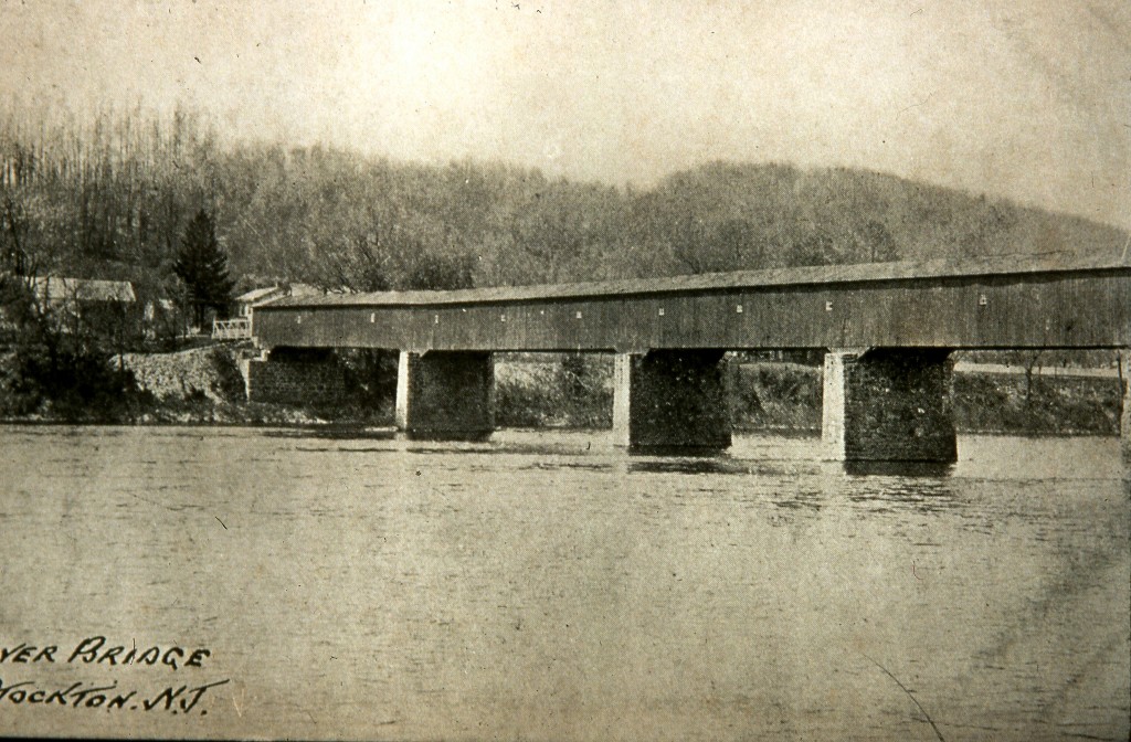
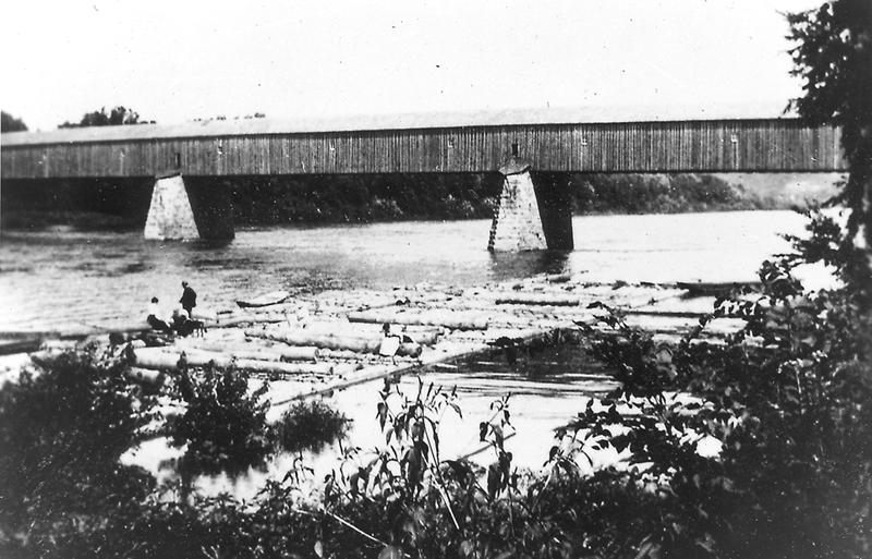
In a recent post I mentioned that I found two items at the Hunterdon County Historical Society that explained what Nathaniel Saxton was doing during the years 1808-1815. Besides investing in Raven Rock and a couple properties in other locations, and becoming an active supporter of the Federalists, Saxton was thinking of infrastructure, in particular, construction of a bridge between Bull’s Island and Lumberville.
Ferries v. Bridges
Up until this time, the only way to get across the river was by ferry. There were several ferries between Coryell’s Ferry (Lambertville) and Alexandria, later known as Frenchtown. The ferry closest to Bull’s Island was run by Martin Johnson, who had taken it over from Jacob Painter. It was located somewhere near the point where Federal Twist Road intersects with Highway 29. All evidence of it has been erased.
By 1810, there were only two bridges over the Delaware River, one at Easton and one at Trenton. They both opened in 1806, and their advantages must have been immediately obvious. A bridge avoided the biggest problem associated with ferries: it could be crossed in almost any kind of weather. Ferries could not run during spring freshets, or when the river was frozen over, or in the summer when the water level dropped too low. It is true that in some of those cases, horse-back riders could simply ride across the river, but often they could not and would have to wait in a nearby tavern for conditions to improve.
Bridges, especially sturdy covered bridges, were the answer. But these were not taxpayer-funded bridges. They were built by private companies, which explains why the bridges at Trenton and Easton were toll bridges. The companies raised funds for construction by selling shares, like any private company could. But the profits, which went toward bridge maintenance and to shareholder dividends, came from the tolls.
Saxton’s Petition

Enterprising people began to look up and down the river for other bridge locations, and Saxton was one of them. In 1810, he printed up a petition to the legislatures and began collecting signatures.1 But he was not the only one circulating petitions. Supporters of a bridge at Howell’s or Mitchell’s Ferry (Stockton) and Coryell’s Ferry (Lambertville) had already submitted petitions to the Pennsylvania and New Jersey legislatures.
In composing his petition, Saxton made the argument for why Bull’s Island was a superior location. He noted that the river at Bull’s Island was far narrower than it was at other locations, making it ideal for a crossing. He calculated the distances between Easton, Trenton, and the three proposed locations, demonstrating that Bull’s Island was “the most central, and on this account the most eligible place.” He also claimed that the location was better for travelers:
The course of the river and the local situation of the country, are such as to give Bull’s-Island the preference. On the Pennsylvania side the roads from Mitchell’s and Coryell’s ferry to Philadelphia, meet at the Buckingham Meeting-House, and from thence follow the Old York Road. By reason of the circuitous course of the river, the distance from each of these places to Philadelphia, on that road, is 34 miles ; the distance from Bull’s Island (as the road is now used falling into the York Road but two miles from Mitchell’s,) is the same, and may be shortened 1 or 2 miles in the first 5, which will make it less than 33 miles to Philadelphia.
And passing over into New-Jersey in the direction of New York, the distance from Philadelphia to Flemington by Coryell’s will be 46 miles, by Mitchell’s or Bull’s-Island 44 miles, and in going to places lying above the direction of Flemington, particularly the upper part of the counties of Hunterdon, Morris, Sussex, and to the state of New-York, (which, on a moderate computation, constitutes three-fourths of the crossing at those ferries,) the route by Bull’s-Island will be upwards of two miles nearer than Mitchell’s, and five miles nearer than Coryell’s.
He even managed to depict the Hunterdon plateau or Croton Swamp as an advantage:
In addition to which, Bull’s-Island lying at the point where the ridge, known at different places by the names of the Cushetunk Mountain, the Flemington and Bohannan’s Hills, terminates on the river, the great portion of travelling may entirely avoid that Hill and have a level road from the directions of Quakertown, Pittstown or Baptistown, through what is called the Great Swamp, or tract of level country lying above this ridge, and arrive by a gradual descent to the river.
It appears from the petitions that Saxton had no trouble getting signatures. I have not counted them up, but there were probably hundreds, from Bucks, Hunterdon, Morris, and Sussex counties (Warren was still part of Sussex). There are at least 25 of these petitions in the collection at the Historical Society. Many of Saxton’s signatures came from residents of Solebury and Buckingham Townships in Bucks County. I wouldn’t be surprised if they also signed Mitchell’s petitions.
The Centre Bridge Company
Despite Saxton’s arguments and his success in collecting signatures, the promoters of a bridge at Mitchell’s Ferry won the day. (It appears that by this time, William Mitchell had taken over the ferry from the Howell family, who originally operated it from the New Jersey side.) I was somewhat confused about the chronology of the bridge petitions and legislation, until I came across a pamphlet titled The Centre Bridge Company, by Elmer Roberson (published by H. E. Deats, Flemington, NJ, 1928). The back and forth between New Jersey and Pennsylvania is a wonder to behold, so I am summarizing it here:
1809 February, residents of Mitchell’s Ferry (today’s Centre Bridge) petitioned the Pennsylvania legislature for a bridge. At the same session, petitions were presented by residents of New Hope for a bridge at their location. No action was taken.
1809 Autumn. The two petitions were presented to the New Jersey Legislature then in session. Two separate acts were passed favoring both locations and then forwarded to Pennsylvania for concurrence.
1809 Autumn. While the Pennsylvania legislature considered these two acts, New Hope residents submitted a petition requesting that the two locations be combined into one law and commissioners appointed to choose the best location. The Pennsylvania legislature passed this act and sent it back to New Jersey for concurrence.
1810-11, Saxton’s petition was now circulating and was presented to the NJ Legislature.
1811 Feb. 18, The New Jersey Legislature combined all three locations into one Act dated Feb. 18, 1811. Commissioners were appointed to represent New Jersey and to view locations along the river from Black’s Eddy south to Well’s Falls. None of the commissioners were from Hunterdon County.
1811, March 23, the Pennsylvania legislature passed an act of concurrence, and named its own commissioners.
1811 Sept 9, The Commissioners of NJ & PA met at the house of William Mitchell (which suggests the decision had already been made), and determined that Mitchell’s Ferry was the best location. They then named new commissioners to “receive subscriptions in stock.” Nathaniel Saxton was not among them.
1812 August/September, The company was not officially chartered until the requisite amount of stock had been purchased. Letters patent of incorporation were issued in New Jersey on August 17, 1812, signed by Gov. Joseph Bloomfield, and in Pennsylvania on September 1, 1812.
The commissioners of the new bridge company chose the name Centre Bridge Company. (I have always wondered about the spelling of Centre Bridge; the R is in the wrong place, but it appears to have been that way right from the beginning.) The name would seem to derive from the fact that it was to stand midway between the bridge at Trenton and the bridge at Easton. However, Elmer Roberson believed it was because the bridge was midway between the two other locations being considered, Bull’s Island and Coryell’s Ferry. Both cases are true.
Once the letters patent had been signed, the commissioners met again at Mitchell’s Ferry on October 21, 1812 and organized their new company. William Mitchell was elected president (no surprise); the New Jersey managers were Saxton’s friends Albertus King and George C. Maxwell, and also Pierson Reading. (I did not see their names on Saxton’s petitions.) The bridge was open for business on January 1, 1814. According to James P. Snell, Centre Bridge did not get its wooden cover until 1832.2

The New Hope Bridge
According to Alfred G. Petrie, the New Hope bridge was promoted by Benjamin Parry of that town, and a bridge company was formed on September 25, 18113 A charter was finally obtained from both Pennsylvania and New Jersey for the New Hope Delaware Bridge Company in the second session for 1812 (New Jersey’s law was passed January 23, 1812), and the bridge was open for traffic on January 13, 1814.
Neither Petrie nor Roberson nor Snell address the question of why the legislatures decided to authorize a second bridge, when the enabling legislation of 1811 only provided for one to be chosen among the three sites proposed. The Act of incorporation for the New Hope bridge company states that
“it has been satisfactorily represented to the legislature that a number of the inhabitants of this state and of the state of Pennsylvania have associated together under the name and style of the “New-Hope Delaware bridge company,” for the purpose of erecting a bridge over the river Delaware at New-Hope (formerly called Coryells ferry) and it is desirable that the legislature would pass a law to incorporate said association, to enable them to carry their laudable undertaking into effect.”
Perhaps New Hope got its bridge because its supporters were so well-organized. The location did have the advantage of a main highway from Philadelphia leading to New Hope, and then on the New Jersey side, running northeast to New Brunswick and on to New York, commonly called the Old York Road.
Why Did Saxton’s Petition Fail?
In a previous post, I described how Nathaniel Saxton had become an important member of the New Jersey Federalist party. In 1808, the governor of New Jersey was Joseph Bloomfield, a skillful politician strongly allied with the Jeffersonian Republicans. His skill was demonstrated in the way he managed to funnel patronage toward his supporters, and clearly, Saxton was not one of them.4 This did not help him in the legislature, which was also dominated by Jeffersonian Republicans. But I think it more likely that the other two locations had more supporters and better logistics than Bull’s Island had.

Eventually, Saxton’s bridge did get built, but not until after the Delaware & Raritan Canal had opened in 1834, which made a bridge at Bull’s Island far more desirable. The Lumberville-Bull’s Island bridge was finally opened in 1835. By that time, Nathaniel Saxton had greatly reduced his land-holdings in Raven Rock, but he still owned the Saxtonville Tavern, so eventually he did benefit from construction of a bridge at Bull’s Island.
Bill Wolfe
May 6, 2012 @ 8:34 am
Hi – thanks for a superb piece on a favorite area of mine (I live in Ringoes).
Folks should be aware that DEP is about to destroy some of the history of Bull’s Island – they are planning to CLEAR CUT 200 year old sycamore’s on the island because one fell and killed a camper last year.
For links to all the documents details, see:
DEP Clear-Cut Plan Would Violate Federal Law
http://www.wolfenotes.com/2012/04/dep-clear-cut-plan-would-violate-federal-law/
Please write or call DEP Commissioner Martin and Gov. Chrisite (609-292-6000) to stop this extreme over-reaction to a freak accident.
Marfy Goodspeed
May 6, 2012 @ 12:50 pm
Thanks Bill.
Yes, this is an unnecessary reaction to a single incident.
Thanks for the link.