Given that the Stockton Inn is now for sale, and a radical proposal for development of the site has been offered by the seller, I thought it would be appropriate to publish this article by Mr. Bush about a previous “improvement” to the Borough that took place not far from the Inn.
roads
The Pittstown Roads
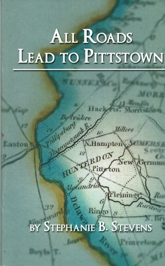
In My Library: “All Roads Lead to Pittstown” by Stephanie B. Stevens
 Better late than never. I’ve finally read Stephanie Stevens’ book All Roads Lead to Pittstown, published by the Hunterdon County Cultural and Heritage Commission. What a fascinating story she has to tell. I was dimly aware of Pittstown’s role in the Revolution, but what Stephanie has found adds enormously to our knowledge of the time. She managed to find references to Pittstown (specifically the mills of Moore Furman) in the letters of George Washington, the pension application of William Anderson, and the journal of James Parker, whose farm was located on Route 513 between Clinton and Pittstown.
Rittenhouse Road

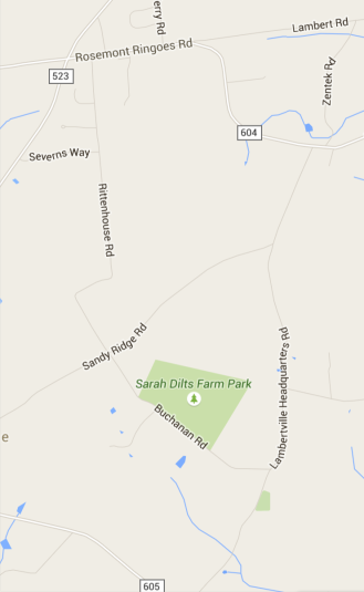
There is an odd sort of road in Delaware Township, running south from Sergeantsville, that I have often wondered about. It is called Rittenhouse Road, and for much of its length, it runs straight as an arrow, then suddenly does a zigzag before ending at Sandy Ridge Road.
Quite often the very straight roads in Hunterdon County were created as a result of the early, large proprietary tracts that forced roads to run along their borders. But that is not the case here. This road ran through the middle of Daniel Robins’ 700+ acres, surveyed in 1722.
John Reading & the Creation of Hunterdon County (part 1)
On November 16, I gave a speech about John Reading and the Creation of Hunterdon County. There was quite a lot of information in that speech, covering the years 1664 to 1718. In fact, it was probably a bit too much.
For example, the beginning of the speech covered the conquest of New Netherland by the English in 1664, the Third Anglo-Dutch War of 1672-74, the Quintipartite Deed of 1676, and John Reading’s settlement in Gloucester County in 1684; also Edward Byllinge and the early settlement of West New Jersey. Rather than rehash material that I have already written about, you can see a list of pertinent articles at the end of this one. They cover the settlement of West New Jersey, its political history, its infamous governor Daniel Coxe, and the early career of John Reading.
For the history of Hunterdon County, it is best to start with 1694. What follows is the first part of a somewhat amended version of the speech.
A House Divided
Howell’s Tavern House and Ferry House

click to enlarge
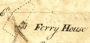
The dotted line in this picture is a survey line, drawn by Reading Howell in 1774, and as you can see, one of the lines goes right through the middle of the house, which is labeled “Ferry House.” Strangely enough, this house has long been known as the tavern house at Howell’s Ferry (Stockton) which I wrote about in “Jacob’s Path, an 1813 Shortcut.” So why was the tavern house called the Ferry House in 1774? And why did the surveyor run a line right through the middle? Therein lies a story.
The Amwell-Hopewell Road of 1736
The Road from Howell’s Mills and
John Reading’s Plantation to Trenton
Recently I wrote about the earliest known public road in Hunterdon County, recorded in January 1721/22 (The Amwell Road of 1721.) The next earliest, at least for the southern part of the county, was dated 1736, and followed part of the earlier route.
I will give the record in full, and then try to identify each course along the route.1
The Amwell Road of 1721
There is something fascinating about old roads, especially when their routes differ from the ones we know today. One of the very oldest roads in Hunterdon County was “layed out” in December 1721 and recorded in January 1721/22.
Here is the full text, as transcribed in Snell’s History of Hunterdon County (p. 347), which I will follow with my attempt to decipher what route was being described.1
Jacob’s Path, an 1813 Shortcut
In his article, “Old Sentinel Oak Has Passed,” Egbert T. Bush wrote that the old oak, across the road from the Baptist Church in Stockton, close to where Route 523 meets Main Street, stood near a “never-failing stream.” This stream runs along Route 523 for some distance and today is a little hard to find. But it does show up on Google maps, and is a clue to two interesting road records of 1813.
Old Sentinel Oak Has Passed
Trees were a subject dear to Mr. Bush’s heart. This article is just one of many in which he waxed both poetic and nostalgic about the grand old trees of his neighborhood.
Included in this article is some early history of the area of Stockton where Route 523, Old Prallsville Road, Ferry Street and Route 29 (Risler Street) all come together. Rather than interrupt Mr. Bush with a long parentheses, I will save my comments for the end of his article.
A Post in the Road
The Old Stone Signpost at Plum Brook
Plus Some Thoughts on Road Names
Recently my friend Paul Kurzenberger brought me a photograph of a postcard showing the location of the old stone signpost that once stood at the intersection of Ferry Road and Locktown-Flemington Road.
