part eight of The Route Not Taken
Proceeding along the proposed railroad route, we come to the village of Sandbrook. If the rail line had been laid out as planned it might have changed the village significantly.
John and Elizabeth Holcombe are thought to have built the oldest house still standing in Hunterdon County, located at the Holcombe-Jimison farm just north of Lambertville.
part eight of The Route Not Taken
Proceeding along the proposed railroad route, we come to the village of Sandbrook. If the rail line had been laid out as planned it might have changed the village significantly.

The Holcombe family is one of the most extensive early families in Hunterdon County. I have included a sixth generation for them, but perhaps I shouldn’t have—there are just so many of them.
Please, share any corrections or additions you might have. And remember, I list the children of daughters, but not their grandchildren.
Once again, I return to Egbert T. Bush’s article, “Sandy Ridge Long a Farm Community.” He wrote:
This is a continuation of Egbert T. Bush’s article, “Old Headstones and Headlines,” which focused on the neighborhood of Sandy Ridge.1
For the final installment of my study of the Haddon Tract,1 I am turning to the remainder of the property that was left to Nicholas Sine. As a reminder, Nicholas Signe/Sayn/Sine was a partner with another German immigrant, Jacob Sniter, in the 1748 purchase of 1300 acres of the Haddon Tract, a 2,000-acre plot that was surveyed for John Haddon in 1711. Daniel Robins had purchased the other 700 acres.
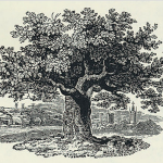
Camp Ground of the Glorious Old Continental Army in 1777
by Jonathan M. Hoppock
originally published in the Democrat-Advertiser, Oct. 10, 1901
From the photograph and from Hoppock’s description, it appears that this “campground” was located along Route 523 near Sand Brook.
At the first town meeting, the Township Committee voted that $1,000 was to be raised for making and repairing roads. Municipalities were responsible for their roads, while the county took responsibility for the bridges. Generally, it was the landowners along the roads who maintained them, so you can imagine what condition they were in: dust in the summer, mud in the spring and downright impassible in the winter, unless you had a sleigh. The township named many people to be Overseers of Roads. It’s hard to say exactly what their responsibilities were. Most likely, they managed the work that was ordered by the Surveyors of Highways.
Myndert Wilson, who purchased the mill lot from George Holcombe for an outrageous $13,000, was smart enough to hand it off a year later to someone else. On March 22, 1815, two months after the Battle of New Orleans, he sold it to James Major of Kingwood.1
The mill once owned by Mahlon Cooper and Robert Curry in Saxtonville became a hot potato during the War of 1812 and thereafter. It changed hands several times before Nicholas Baird acquired it in 1823.
Note: It has been awhile since I last wrote about life in Raven Rock. Here are the previous posts: Saxton in Raven Rock, Reading Howell’s Map, The Bull’s Island Bridge, and Saxton’s Saxtonville.